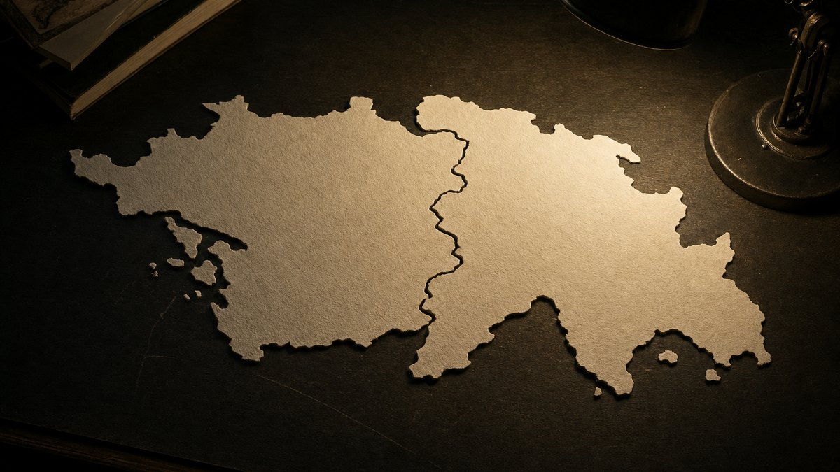
Alfred Wegener noticed that South America and Africa fit like two pieces of a torn page, and then checked whether the writing matched across the tear: fossils, mountain belts, coal seams and glacial scratches all line up. He was dismissed for thirty years for having no mechanism, died on the Greenland ice at fifty, and was proved right by the floor of the sea. Reassemble Pangaea, switch on the evidence, and run the spreading ridge. Episode 09 of the Great Scientists series.
Interactive 3D film8 min1880 to 1930Published 2026-10-13
The coastlines match. So does everything written on them.
Look at a world map and the coasts of South America and Africa look like two pieces of a torn page. People had been saying so for three hundred years.
Wegener did the thing that turns a resemblance into an argument. If the page was torn, then the lines of print should run across the tear.
So he checked. Fossil species, rock formations, mountain belts, coal seams, glacial scratches — four independent kinds of writing, and they all line up.
And he was dismissed for thirty years, because he could not say what moves a continent.
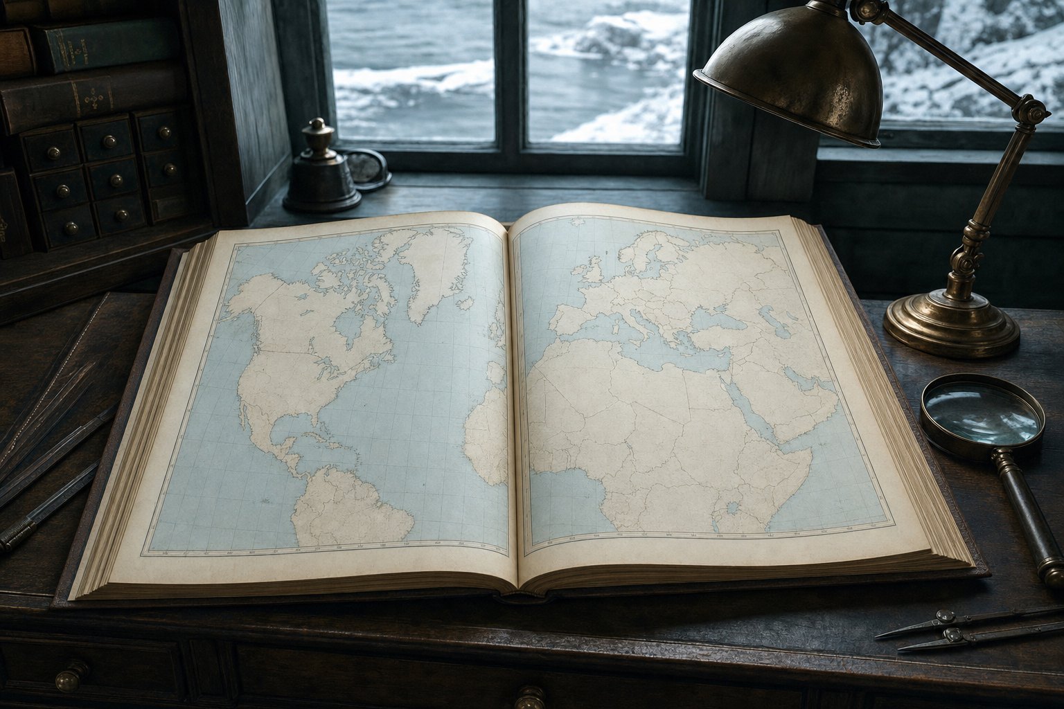
An atlas, open He was not the first to notice the fit. He was the first to go and check it.
1912
he presents continental drift
30
years of rejection
1930
dies on the Greenland ice
The shape of the story
It is just as if we were to refit the torn pieces of a newspaper by matching their edges, and then check whether the lines of print run smoothly across.Alfred Wegener, 1915
Prologue · Why he matters
The fit
Wegener’s argument was not that the coasts look alike. It was that fossils, rock belts, coal seams and glacial scratches all continue across the join — the lines of print running over the tear.
Born
Berlin, 1880
1 November
Died
Greenland, 1930
on the ice cap, aged 50
Accepted
1960s
thirty years after his death
How to use: pick a chapter below or press ← → to change step · ▶ plays the step · drag to rotate · three steps have buttons you can press.
The textbook picture in 1910 was a cooling Earth. As the interior shrinks, the crust wrinkles, and the wrinkles are mountain ranges.
Continents stayed where they were made. The problem was that identical fossils kept turning up on continents separated by whole oceans.
The accepted answer was land bridges: enormous isthmuses that once connected the continents and then conveniently sank without trace.
That is the intellectual situation Wegener walked into: a theory that explained mountains and a patch that explained fossils, with nothing holding them together.
The Earth is cooling and shrinking
Mountains are wrinkles, like a dried apple
Continents and oceans never move sideways
Land bridges sank to explain shared fossils
The contraction theoryMatching fossils, awkward distances The same extinct species turn up on continents thousands of kilometres apart.
sunk
the land bridges nobody could find
The standard fix
Chapter I · Step 1
A shrinking apple
Geology in 1910: the Earth is cooling and contracting, mountains are wrinkles, continents never move sideways, and identical fossils on separate continents are explained by land bridges that sank.
His doctorate was in astronomy and his job was weather.
Wegener was not a geologist, which is part of why the geologists would not listen.
His doctorate was in astronomy, his working field was meteorology, and in 1906 he and his brother set a world record by staying up in a balloon for fifty-two and a half hours.
He spent four expeditions on the Greenland ice cap studying polar air, and he was genuinely good at it.
In 1911 he read a paper listing fossil species that appear on both sides of the Atlantic, went looking for more, and found that the pattern was everywhere.
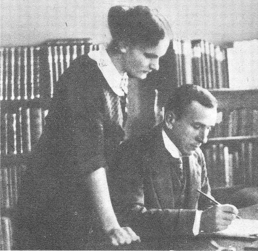
Alfred Wegener Photographed in 1913 with his wife Else, daughter of his mentor Wladimir Köppen.
1905 Doctorate in astronomy
1906 Sets a balloon endurance record with his brother
1906–08 First Greenland expedition
1912 Presents continental drift
Before the idea
52.5
hours aloft: a world record in 1906
The balloon
Chapter I · Step 2
An outsider with a balloon record
An astronomer by training and a meteorologist by trade, with a 1906 world record of 52.5 hours in a balloon and four Greenland expeditions. Being an outsider is part of why he saw it — and part of why he was dismissed.
On the sixth of January 1912 Wegener stood up in Frankfurt and told a room of geologists that the continents had once been a single mass and had since moved apart.
The coastline fit is suggestive but sloppy, because a coastline is just where the sea happens to stand today. The real edge of a continent is the outer edge of its shallow shelf, often a hundred kilometres further out.
Fit those edges instead and South America and Africa close to within about a degree, which is as good as the data allows.
Press the button and close the Atlantic.
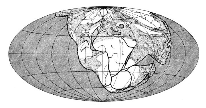
His own reconstruction Wegener’s maps of the single landmass breaking up, from the later editions of his book.
Fit the coastlines and the match is rough
Fit the edge of the continental shelf instead
Now the gap is under a hundred kilometres
That is the real edge of a continent
Where the edge really is
~1
supercontinent, which he called Pangaea
The claim
Chapter II · Step 3 · Interactive
Put them back
Presented on 6 January 1912. Fitting the continental shelf edges rather than today’s coastlines closes the Atlantic to within about a degree — a far better match than a school atlas suggests.
Press Reassemble to close the ocean and Break up to let it open again. The reconstruction is schematic.
Wegener’s picture was a single supercontinent he called Pangaea, surrounded by one ocean, which broke apart and whose fragments drifted to where we find them.
The timescale is the part people find hard. Pangaea assembled about three hundred and thirty-five million years ago and started to split about a hundred and seventy-five million years ago.
The Atlantic is still opening, at around two and a half centimetres a year. That is roughly how fast your fingernails grow.
Slow enough to be invisible in a human life, and fast enough to move a continent five thousand kilometres in a couple of hundred million years.
~335 Ma Pangaea assembles
~175 Ma it begins to break up
~140 Ma the South Atlantic starts to open
today the Atlantic widens about 2.5 cm a year
The timetable
2.5 cm
a year: roughly how fast your fingernails grow
The speed Slow enough to be invisible, fast enough to move a continent across an ocean in a hundred million years.
Chapter II · Step 4
Pangaea
A single supercontinent that assembled about 335 million years ago and began breaking up about 175 million years ago. The Atlantic is still widening at roughly 2.5 cm a year — fingernail speed.
Here is why the fit is not a coincidence. Switch on the layers and watch what crosses the join.
Mesosaurus was a small freshwater reptile. Its fossils are in Brazil and in South Africa, and it could not swim an ocean.
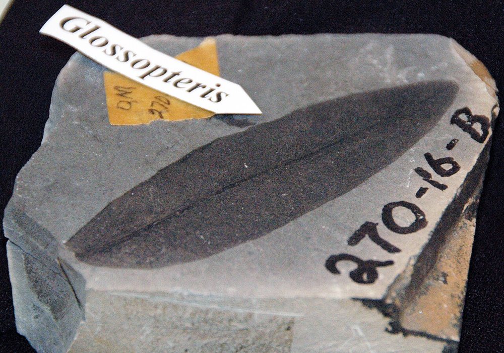
Glossopteris was a seed fern whose seeds are far too heavy to blow across water, and it is found in South America, Africa, India, Australia and Antarctica.
The Appalachian mountains stop at the Atlantic and start again in Scotland and Norway, same age, same rocks.
And coal, which only forms in warm swamps, is mined in Spitsbergen, well inside the Arctic Circle.
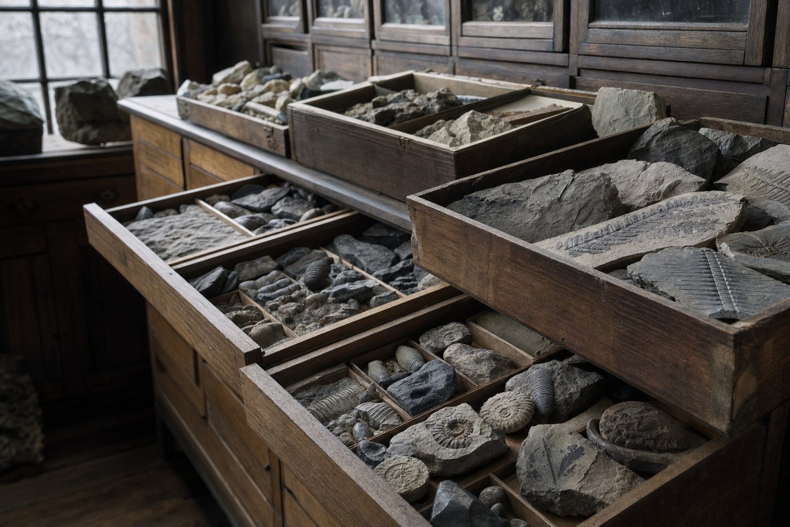
Glossopteris A seed fern found across South America, Africa, India, Australia and Antarctica. Its seeds are too heavy to cross an ocean.
Mesosaurus: a freshwater reptile, Brazil and South Africa
Glossopteris: a fern on five continents
The Appalachians continue into Scotland and Norway
Coal, which needs swamps, is found in Spitsbergen
Four kinds of writing
5
continents sharing one fern
Glossopteris
Chapter III · Step 5 · Interactive
The writing crosses the tear
Four independent records continue across the join: Mesosaurus and Glossopteris fossils, the Appalachian–Caledonian mountain belt, Arctic coal, and glacial scratches in what are now deserts.
Press the layer buttons to lay each line of evidence over the reassembled continents.
Either the whole planet froze, or those countries were somewhere else.
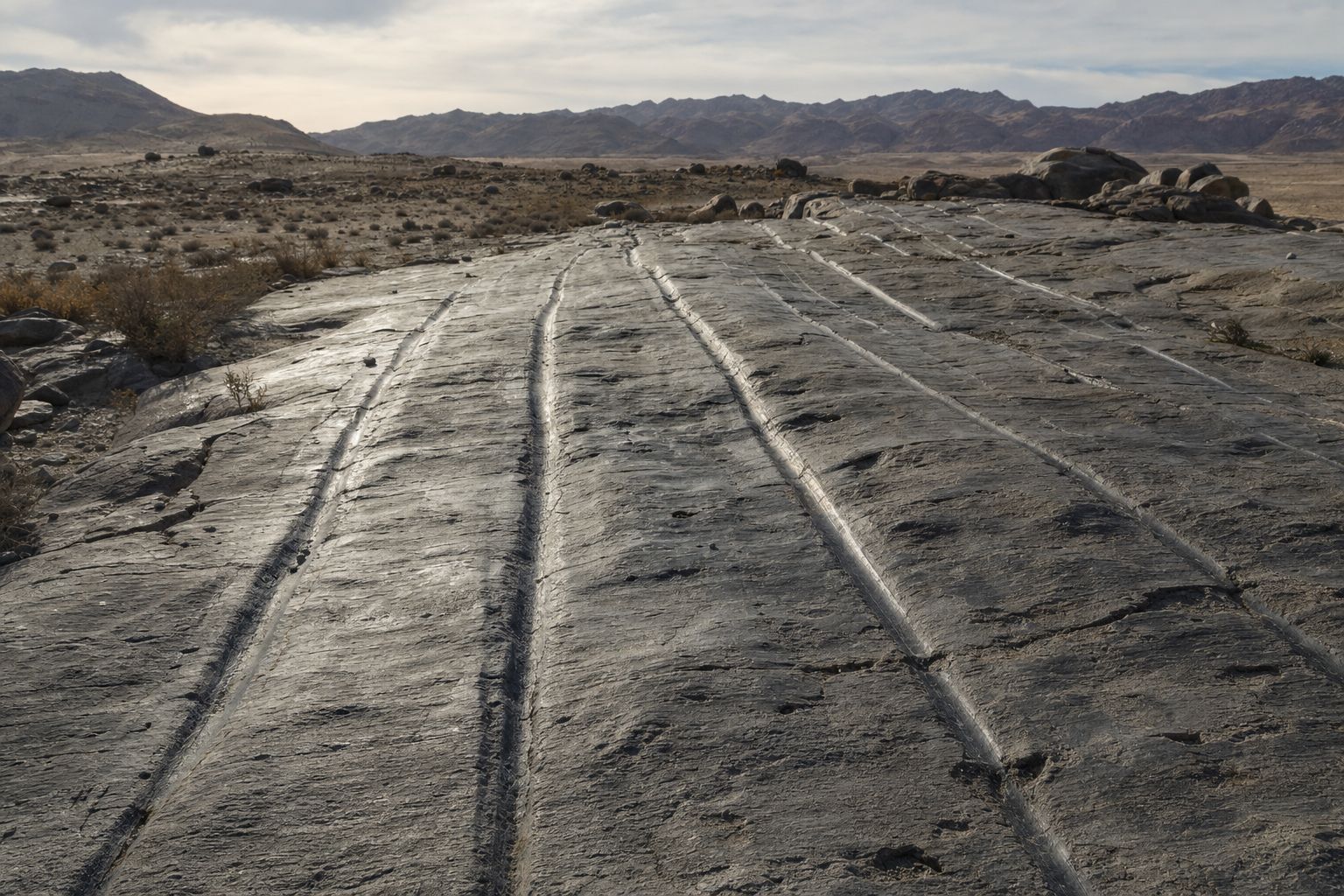
The strongest evidence is the strangest. In India, central Africa, Brazil and Australia there are rocks scoured by a continental ice sheet about three hundred million years ago.
Those places are tropical. An ice sheet thick enough to grind bedrock could not have sat on them where they are now.
And the scratches have directions. On today’s map they point in incoherent directions, outward from nothing.
Put the continents back into Pangaea and all the scratches radiate neatly from a single ice cap over what is now southern Africa and Antarctica.
Glacial scratches in hot countries Rock polished and gouged by ice, now in India, Brazil and central Africa.
Ice sheets leave parallel scratches and dumped debris
Those marks are found in India, Africa, Australia, Brazil
All tropical or subtropical today
The scratches point outward from one centre — if you reassemble them
The strongest line
~300 Ma
the ice age that left them
When
Chapter III · Step 6
Glacier marks in the tropics
Rock scoured by an ice sheet 300 million years ago is found in India, Brazil, central Africa and Australia. On today’s map the scratch directions make no sense; on a reassembled Pangaea they radiate from one ice cap.
He had the evidence and not the cause — and that was enough to bury it.
Wegener knew the weakness and said so. He had assembled the evidence that continents move, and he could not say what moves them.
The forces he suggested — the Earth’s rotation flinging continents towards the equator, and tidal drag from the Moon — are real, and they are far too feeble. Harold Jeffreys showed they were off by orders of magnitude.
That was fatal. Geologists concluded that if the proposed mechanism is impossible, the conclusion must be wrong too — which does not follow, but is how people reason.
At a 1928 symposium in New York the theory was taken apart. One senior figure called it utter, damned rot.
What force pushes a continent sideways?
He offered the Earth’s rotation and tidal drag
Harold Jeffreys calculated them: far too weak
He was right about that, and it sank the theory
The hole in the argument
Utter, damned rot!The president of the American Philosophical Society, on continental drift
1928
a symposium convened largely to reject it
The reception
Chapter IV · Step 7
No engine
Wegener’s proposed forces — rotation and tidal drag — were shown by Harold Jeffreys to be orders of magnitude too weak. With no plausible mechanism, geologists rejected the conclusion as well, which does not follow.
Arthur Holmes published the engine a year after Wegener died.
The mechanism existed. One year after Wegener died, the British geologist Arthur Holmes proposed that the mantle convects — slow currents of hot rock rising, spreading sideways, and sinking.
The crust rides on top of those currents like scum on a simmering pan. Continents are not ploughing through the ocean floor; the ocean floor is moving too.
It was essentially right. It was also untestable with the instruments of 1931, and it was treated as speculation.
The evidence that settled it did not come from the land at all.
Arthur Holmes proposed mantle convection in 1931
Heat rises, drags the crust sideways, sinks again
Continents ride on the flow, they do not plough through it
It was the right idea, thirty years early
Holmes, 1931
1931
the mechanism is published
1960s
the year it is taken seriously
Thirty years in between
Chapter IV · Step 8
Somebody had it
In 1931, a year after Wegener’s death, Arthur Holmes proposed mantle convection: continents ride on moving crust rather than ploughing through it. Right, and thirty years too early to test.
The last journey was a supply run, not an experiment.
Wegener spent his last years leading a scientific expedition to the Greenland ice cap, measuring its thickness and the weather above it.
In 1930 the team at the inland station, four hundred kilometres from the coast, had not received their supplies and would not survive the winter without them.
Wegener led a relief party through worsening weather and reached them on his fiftieth birthday. There was not enough food for everyone to stay, so he turned round with one companion and started back.
He died somewhere on the way, probably of heart failure. His companion buried him carefully in the snow and then also died. The body was found the following May, marked by a pair of skis set upright in the ice.
Eismitte A weather station in the middle of the Greenland ice cap, four hundred kilometres from the coast.
Sep 1930 Supplies fail to reach the inland station
Oct 1930 Wegener sets out with supplies and two companions
1 Nov 1930 His fiftieth birthday, at the station
~Nov 1930 Dies on the return journey
The last expedition
−50 °C
the conditions on the ice that winter
May 1931
his body is found
The end
Chapter V · Step 9
He went back to the ice
Leading a relief party to a stranded inland station, Wegener reached it on his fiftieth birthday, turned back for lack of supplies, and died on the return. His body was found in May 1931, marked by upright skis.
Nothing on the ocean floor is older than the dinosaurs.
After the Second World War, ships with sonar mapped the sea floor properly for the first time, and found a mountain chain running down the middle of the Atlantic with a rift along its crest.
They also found something that should not be possible. The ocean floor is young. Nowhere on Earth is the sea bed older than about two hundred million years, while continental rocks go back four billion.
In 1962 Harry Hess drew the conclusion: new sea floor is being made at the ridges and pushed outwards, and old sea floor is being destroyed down the deep trenches.
The continents are not ploughing through the ocean. They are passengers.
Mapping the sea floor Wartime sonar and post-war surveys revealed a mountain range running down the middle of every ocean.
The sea floor is young — nowhere older than 200 million years
The continents are up to 4 billion years old
So the ocean floor is being made and destroyed
Made at the ridges, swallowed at the trenches
Hess, 1962
~200 Ma
the oldest sea floor anywhere
The giveaway
Chapter VI · Step 10 · Interactive
The floor is new
Sonar surveys found a ridge down the middle of each ocean — and sea floor nowhere older than about 200 million years, against four-billion-year-old continents. Hess (1962): the floor is made at the ridges and destroyed at the trenches.
Press Spread to run the ridge and watch new floor appear on both sides.
Symmetrical magnetic stripes, and the argument was over.
The clinching evidence was magnetic. The Earth’s field reverses at irregular intervals, and lava freezing at a ridge locks in whichever direction the field had that day.
So the sea floor is a tape recording. Fred Vine and Drummond Matthews realised in 1963 that if the floor spreads, the recording must be symmetrical: the same sequence of stripes on both sides of the ridge, mirrored.
They went and looked, and it is.
There is no way to produce a mirrored magnetic barcode except by making new floor in the middle and carrying it outwards in both directions. Within five years plate tectonics was standard geology.
The Earth’s magnetic field flips at random intervals
New sea floor freezes in the field direction of its day
So the floor records a barcode of reversals
And the barcode is a mirror image on both sides of the ridge
Vine and Matthews, 1963
mirror
the pattern on either side of the ridge
The proof A symmetrical magnetic barcode is impossible unless the floor is spreading.
1968
plate tectonics is standard geology
Six years later
Chapter VI · Step 11
A barcode in the rock
The Earth’s magnetic field reverses; cooling lava records its direction. Vine and Matthews (1963) predicted that a spreading floor must show mirrored stripes either side of the ridge. It does. By 1968 plate tectonics was standard.
Satellites measure the drift in centimetres a year.
What Wegener could only infer, we can now measure. Permanent satellite stations track the continents in real time.
The Atlantic is widening by about two and a half centimetres a year. The fastest plates move around ten.
He was wrong about the speed — his estimates were far too fast, because he was using inaccurate longitude measurements from Greenland. He was right about everything else.
And the mechanism he lacked turned out not to be in the continents at all. It is in the ocean floor, which he had no way to see.
GPS stations now measure plate motion directly
The Atlantic widens about 2.5 cm a year
The Pacific plate moves up to about 10 cm a year
Wegener’s estimates were too fast, his direction right
What we can see now
2–10 cm
a year, plate speeds measured by satellite
Today
Epilogue · Step 12
We can watch it happen
Satellite geodesy now measures plate motion directly: the Atlantic widens about 2.5 cm a year, the fastest plates reach about 10 cm. Wegener’s speeds were too high; his direction of travel was right.
He had the evidence. He did not have the engine. That was enough to lose thirty years.
Wegener assembled four independent lines of evidence pointing to one conclusion, and offered a mechanism that was wrong.
His critics attacked the mechanism, which was fair, and then dismissed the evidence, which was not. The pattern in the rocks did not stop being there because nobody could explain it.
Thirty years were lost, and he did not live to see it fixed.
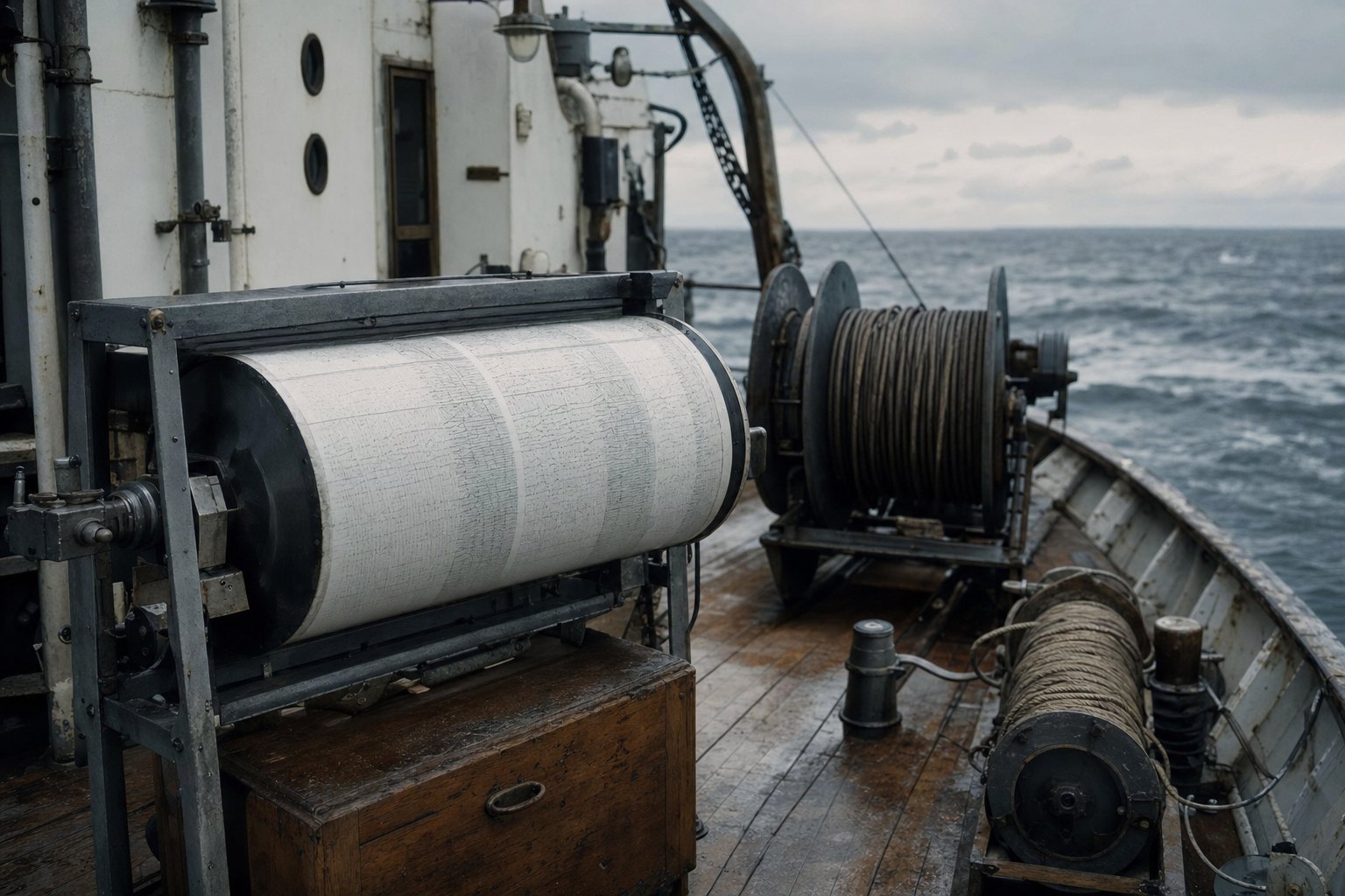
The chapter stills in this film are AI-generated. The photograph of Wegener, his own reconstruction maps and the fossil leaf are real. Sources are listed below.
1912 continental drift proposed
1928 rejected at a symposium
1930 Wegener dies on the ice
1962–63 seafloor spreading and the magnetic stripes
1968 plate tectonics
Fifty-six years
He had the right conclusion
And the wrong mechanism
Both things are normal in science
Rejecting a conclusion for lacking a mechanism is not
What to take from it
Epilogue · Step 13
Right, and not believed
Wegener had four independent lines of evidence and the wrong engine. His critics were right about the engine and wrong to throw out the evidence with it — and the cost was thirty years.
1912–15 continental drift proposed and published
1930 dies on the Greenland ice cap
1962–63 seafloor spreading and magnetic stripes
1968 plate tectonics is standard
Chapter stills in this film are AI-generated illustrations. The 1913 photograph of Wegener, his own Pangaea reconstruction and the Glossopteris fossil are real, credited where they appear.