PlanetPast

World Empires · Episode 08 · AD 802–1431

The Khmer Empire of Angkor

From the trading kingdom of Funan and Jayavarman II's ceremony of 802 to the reservoirs of Angkor, temples at Phimai and Phanom Rung, Angkor Wat, Jayavarman VII and the Bayon, Zhou Daguan's eyewitness account, the rise of Sukhothai, Ayutthaya and Lan Xang, the shift of the Khmer capital south around 1431, and Angkor today. Episode 08 of the World Empires series.

Interactive 3D film6 minAD 802 to 1431Published 2026-10-13

Watch the interactive filmอ่านภาษาไทย

Prologue

World Empires · Episode 08

The Khmer Empire of Angkor

Six centuries of temples, water and kings.

Long before Angkor, the lower Mekong was home to trading kingdoms. Chinese visitors called the earliest one Funan. Its port at Óc Eo, in today’s Vietnam, traded with India and even received Roman coins.

From India came ideas: Sanskrit, Hindu gods, Buddhism, and the idea of the king as a universal ruler. Local peoples reshaped them into something new.

Prologue · Episode 08 of the World Empires series

Before Angkor

Chinese sources describe Funan (1st–6th centuries) and then Chenla (6th–8th centuries). Historians debate how unified these really were; they may have been groups of smaller states.

Grey outlines show other powers of the time. Outlines are approximate.

Sources: Wikipedia: Khmer Empire

Chapter I · Rise

Chapter I · AD 802

A king above kings

Jayavarman II on the sacred mountain.

In 802, according to an inscription carved 250 years later, a ruler named Jayavarman II held a ceremony on the Kulen hills, declaring himself a chakravartin, a “universal monarch”.

The ceremony declared independence from “Java”, which scholars interpret in different ways. Historians now treat 802 as a traditional date rather than a sudden beginning.

Jayavarman II and his successors built their capitals on the plain north of the great lake, the Tonle Sap.

Chapter I · Step 1

A king above kings

Ceremony on Phnom Kulen
802
Sdok Kok Thom inscription, 1052
Early capital
Hariharalaya
Roluos
Sources: Wikipedia: Khmer Empire

Chapter I · 889–1000

A city of water

Reservoirs, canals and rice.

Around 889, King Yasovarman I founded a new capital, Yasodharapura, at Angkor. Next to it his workers dug a reservoir seven kilometres long, the East Baray.

Later kings dug even larger reservoirs and canals. The system stored monsoon water and spread it across rice fields.

Airborne laser scans show that Greater Angkor covered around a thousand square kilometres, the largest city of the world before the industrial age by area.

Chapter I · Step 2

A city of water

West Baray
~8 × 2.1 km
Greater Angkor
~1,000 km²
urban complex, Evans et al. 2007

How much the barays were used for irrigation, and how much for religious symbolism, is still debated.

Sources: Evans et al., “A comprehensive archaeological map of the world’s largest preindustrial settlement complex at Angkor”, PNAS 2007; UNESCO: Angkor

Chapter I · 1000–1150

Roads to the provinces

Temples across today’s Thailand, Laos and Vietnam.

Khmer kings extended their power across the Khorat plateau and into the Chao Phraya basin. Roads with bridges and rest houses linked Angkor to its provinces.

Great temples were built at Phimai and Phanom Rung, in today’s north-east Thailand, and Lavo, today’s Lopburi, became a major centre.

These places were not simply “Khmer” or “Thai” in the modern sense: they were home to many peoples, including Mon and Khmer speakers, under shifting overlords.

Chapter I · Step 3

Roads to the provinces

  • late 11th c. Prasat Hin Phimai
  • 10th–13th c. Phanom Rung
  • 11th c. Lavo (Lopburi) under Khmer rule

Modern borders did not exist. Both Thailand and Cambodia today treasure these temples as part of their heritage.

Sources: UNESCO tentative list: Phimai, its cultural route and the associated temples; Wikipedia: Khmer Empire

Chapter II · Height

Chapter II · 1113–1150

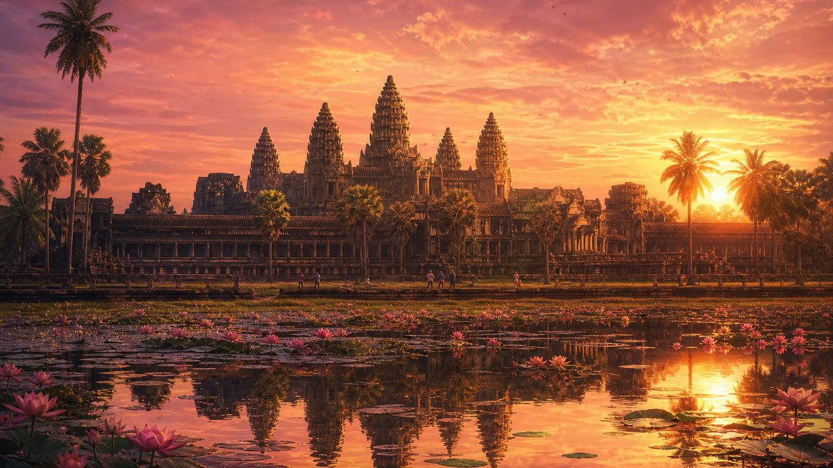
Angkor Wat

The largest religious monument on Earth.

King Suryavarman II ruled from 1113 to around 1150. He built Angkor Wat, a temple for the Hindu god Vishnu, and possibly also his funerary temple.

Its five towers represent Mount Meru, the centre of the universe. Its moat and walls enclose about 160 hectares.

Its galleries carry hundreds of metres of carved scenes, from Hindu epics to the king’s own armies on parade.

Chapter II · Step 4

Angkor Wat

Built
c. 1113–1150
Site
~162 ha
inside the moat

Angkor Wat faces west, unusual for a Khmer temple; scholars link this to Vishnu or to a funerary role.

Sources: UNESCO: Angkor; Wikipedia: Khmer Empire

Chapter II · 1177–1218

Jayavarman VII

From disaster to the empire’s greatest builder.

In 1177 a fleet from Champa, in today’s central Vietnam, sailed up the Mekong and sacked Angkor.

A prince, Jayavarman VII, drove the Cham out and was crowned in 1181. A Mahayana Buddhist, he built a new walled city, Angkor Thom, with the Bayon temple at its centre.

His inscriptions list 102 hospitals and 121 rest houses along the roads. Under him the empire probably reached its greatest extent.

Chapter II · Step 5

Jayavarman VII

Reign
1181 – c. 1218
Hospitals
102
per inscriptions
Rest houses
121
Peak area
~1M km²
estimate
Sources: Wikipedia: Jayavarman VII; Wikipedia: Khmer Empire

Chapter II · 1296–1297

A Chinese visitor

The only eyewitness account of daily life.

In 1296 a Chinese envoy, Zhou Daguan, arrived from the Mongol Yuan court and stayed about a year.

He described golden towers, royal processions, markets run by women, bathing in the rivers and the king appearing at a palace window.

His short book is the only detailed eyewitness description of Angkor from the time it was a living capital.

Chapter II · Step 6

A Chinese visitor

Zhou Daguan at Angkor
1296–1297
Book
“A Record of Cambodia: the Land and Its People”
Sources: Wikipedia: Zhou Daguan

Chapter III · Change

Chapter III · 1238–1351

New neighbours

Theravada Buddhism and the Tai kingdoms.

In the 1200s and 1300s Theravada Buddhism spread among ordinary people across the region, replacing the costly royal temple cults of Angkor.

Tai-speaking kingdoms rose on the empire’s western and northern edges: Sukhothai around 1238, Lan Xang in 1353, and Ayutthaya, founded in 1351.

Much of their court culture, from royal vocabulary to ceremonies and the Thai script itself, grew out of Khmer models.

Chapter III · Step 7

New neighbours

  • c. 1238 Sukhothai
  • 1351 Ayutthaya
  • 1353 Lan Xang

The Thai script was developed from the Old Khmer script in the late 13th century.

Sources: Wikipedia: Khmer Empire; Wikipedia: Thai script

Chapter III · c. 1431

The capital moves south

Why did Angkor fade?

Ayutthaya attacked Angkor several times. Chronicles date its capture to 1431, and that year is often given as the “fall of Angkor”.

Most historians now see a slower change. Tree rings show severe droughts and floods in the 1300s and 1400s that may have damaged the water system.

Trade was also shifting to the sea. The Khmer court moved south to the area of Phnom Penh, on the Mekong, closer to the sea routes.

Chapter III · Step 8

The capital moves south

  • war Attacks from Ayutthaya; capture c. 1431 (chronicles)
  • climate Megadroughts and floods, 14th–15th c.
  • trade Shift to maritime commerce on the Mekong
  • religion Less royal temple-building under Theravada

Thai and Cambodian chronicles tell these events differently; dates for this period are uncertain.

Sources: Wikipedia: Fall of Angkor; Buckley et al., “Climate as a contributing factor in the demise of Angkor”, PNAS 2010

Chapter III · 1795–1907

Never really lost

Monks, a French explorer, and a border treaty.

Angkor was never truly abandoned. Buddhist monks kept Angkor Wat as an active monastery, and pilgrims came from across the region.

From 1795, the provinces of Battambang and Siem Reap, which includes Angkor, were administered by Siam. In 1860 the French naturalist Henri Mouhot made the ruins famous in Europe.

Under a treaty of 1907, Siam ceded those provinces to French-ruled Cambodia. Episode 12 tells the wider story of that colonial era.

Chapter III · Step 9

Never really lost

  • 1795 Battambang and Siem Reap under Siamese administration
  • 1860 Henri Mouhot visits Angkor
  • 1907 Franco-Siamese treaty: provinces ceded to French Cambodia
Sources: Wikipedia: Franco-Siamese Treaty of 1907; UNESCO: Angkor

Chapter IV · Legacy

Chapter IV · 1992 → today

Angkor today

Heritage, science and identity.

In 1992 Angkor became a UNESCO World Heritage site. Angkor Wat appears on Cambodia’s national flag.

Since 2012, airborne laser scanning, lidar, has revealed whole cities hidden under the forest around Angkor and on Phnom Kulen.

The temples, the art and the ideas of kingship of Angkor are a shared heritage of mainland Southeast Asia.

Chapter IV · Step 10

Angkor today

UNESCO site
1992
Angkor Archaeological Park ~400 km²
Lidar surveys
2012, 2015
Sources: UNESCO: Angkor; Evans et al., “A comprehensive archaeological map of the world’s largest preindustrial settlement complex at Angkor”, PNAS 2007

Epilogue

Epilogue

An empire of water and stone

A small kingdom’s giant legacy.

At its height, the Khmer Empire was the strongest power in mainland Southeast Asia, at the same time as the Song dynasty in China and the Crusades in the Middle East.

Its temples still stand in Cambodia, Thailand, Laos and Vietnam.

Next: the Mongols, who built the largest land empire in history.

Epilogue

An empire of water and stone

  • 802 Jayavarman II, traditional founding
  • c. 889 Yasodharapura (Angkor)
  • c. 1150 Angkor Wat
  • 1181 Jayavarman VII; Angkor Thom
  • c. 1431 Court moves south
The series
  1. 00The Rise and Fall of Empires (overview)
  2. 01The First Empires: Mesopotamia
  3. 02Egypt of the Pharaohs
  4. 03Persia and Alexander
  5. 04The Maurya Empire of India
  6. 05China Unified: Qin and Han
  7. 06Rome
  8. 07The Islamic Caliphates
  9. 08 The Khmer Empire of Angkor (this film)
  10. 09The Mongol Empire
  11. 10The Ottoman Empire
  12. 11The Aztec and Inca Empires
  13. 12The Age of Sea Empires
  14. 13The End of Empires

The still images on the chapter cards are AI-generated illustrations. Outlines are approximate.
Sources: Wikipedia: Khmer Empire; UNESCO: Angkor; Wikipedia: Fall of Angkor